Premium · Flight map poster
Print your flights as a personal world map poster
Some maps belong on a wall, not just a screen. YourFlights turns your logged flights into a clean 2D world map with every route drawn between airports, then exports it as a high-resolution, print-ready image you can frame and hang at home. The HD, watermark-free export is part of YourFlights Premium.
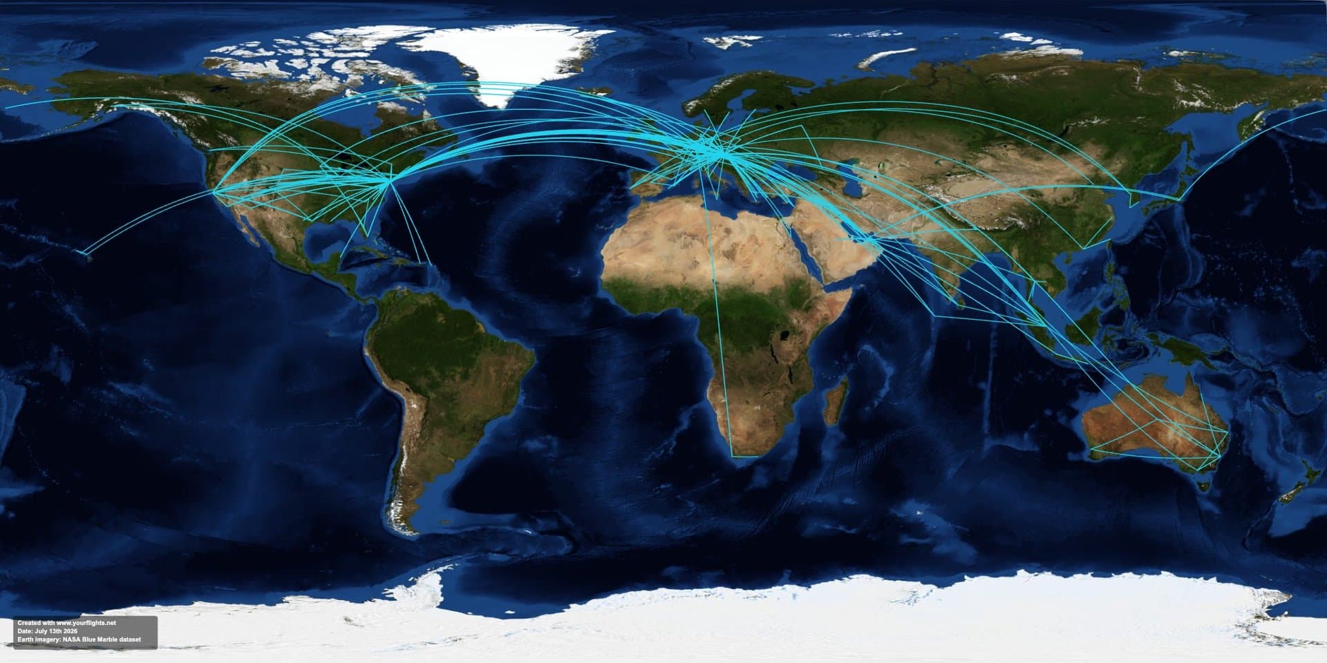
A print-ready poster of everywhere you have flown
Digital views are great for exploring, but there is something about a real map on the wall. The 2D map renders your entire flight history as arcs across a flat world map, built from the same data as your flight globe and flight statistics, laid out and sized for print.
Pick a style, then export. Free downloads carry a small YourFlights mark; Premium unlocks a clean, high-resolution image sized for large prints, so the routes stay crisp whether you order an A2 poster or a poster-size canvas.
From logbook to wall art
Log or import your flights, open the 2D map, choose a style, and export. Order a print from any photo service, frame it, and you have a personal world map that actually means something, because every line is a trip you took.
A gift for the frequent flyer in your life
A personalized flight map is a natural gift for the traveler who has everything: an anniversary of trips taken together, a retirement of business miles, or a send-off before a big journey. Because it is built from real flights, no two maps are alike.
Frequently asked questions
Is the flight map free or Premium?
You can create and preview your 2D map for free and download a standard image that includes a small YourFlights mark. The high-resolution, watermark-free export sized for printing is part of YourFlights Premium.
What can I print, and how big?
The Premium HD export produces a high-resolution image suitable for large-format prints such as A2 posters or canvas. Use any online print service or a local print shop; the file is a standard image.
Where do the routes come from?
Every route is drawn from the flights in your logbook, using the same airport coordinates as the rest of YourFlights, so your poster matches your real history. Import past flights first for a complete map.
How is this different from the flight globe?
The flight globe is an interactive 3D globe for exploring on screen. The flight map is a flat 2D world map built for one thing: a beautiful, high-resolution image you can print and hang.
Can I make the map on the web?
Yes, and the web is the place to do it: the 2D map and its high-resolution export are a web app feature, available in the signed-in web app at yourflights.net. Log or import your flights on any device, then open the map on the web when you are ready to create and export your poster.
Put your travels on the wall
Log or import your flights, open the 2D map, and export a print-ready world map poster. Premium unlocks the high-resolution, watermark-free version.

Free to start · Syncs with your account · Import-friendly
Explore related features
Flight globe
Visualize every route on an interactive 3D globe with filters and exploration tools.
Learn more →Flight statistics
Charts and metrics for distance flown, airports visited, aircraft types, and trends.
Learn more →Flight logbook
Log airlines, routes, aircraft, cabins, and seats in a searchable personal archive.
Learn more →